Short answer if you're in a hurry
The logic of walking in Karaganda is shaped by two things: steppe wind and an industrial backdrop. The city sits on an open plateau at 550 m, with no mountains or forests around for shelter — so for most of the year wind turns any walk into a test of character. In winter that's −30°C with a slicing northwesterly; in summer it's +30°C with dust drifting from the south
The Soviet planners did pull through, though: in the heart of the New City sits the long Bukhar-Zhyrau Avenue with a green axis and fountains, the 40-hectare Central Park, Miners' Park and Victory Park. That's enough to hide between trees in a winter wind and stay in the shade in summer. Outside the city: Sosnovka pine forest, Fedorov reservoir, and for special occasions the 210-km drive to Karkaraly for a full weekend
Pick a route for your steps and energy
Find a route by steps and effort
Check the wind and air first
In Karaganda the dominant weather variable is wind: open steppe in every direction and almost no surrounding forest mean 7–10 m/s is normal for most of the year. In winter at −30°C that translates to an effective −40, and any open square becomes a trial. Before stepping out:
- Windy.com — hourly wind forecasts, direction and gusts. If the arrows are above 8 m/s, walk between buildings on Bukhar-Zhyrau rather than across an open park
- kazhydromet.kz — official Karaganda stations. Air, temperature, wind. Slow updates but reliable
- airkaz.org — independent sensor network across the city. Maikuduk and the Temirtau side stay consistently worse than the centre
- 2GIS — for tram and bus routes. The Karaganda tram network is still alive and is the most comfortable way to cross the city in winter
What the PM2.5 numbers mean (μg/m³): 0–12 clean, 13–35 acceptable, 36–55 head for the Botanical Garden or Sosnovka, 56+ outdoor exercise is risky, especially for kids and seniors. In winter, on a windless day around the private-house belt, readings can sit at 80–120 for hours
City routes — for weekdays and bad weather
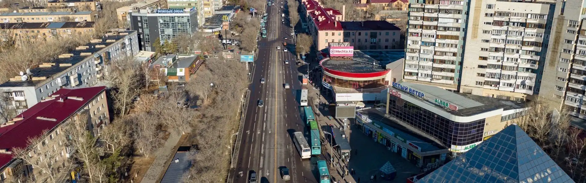
1. Bukhar-Zhyrau from TSUM to Kirov Street
Length: ~3.5 km one way · Steps: ~5,500 one way, ~11,000 round trip · Elevation: almost flat
The main pedestrian axis of Karaganda and the heart of the New City. Stalinist buildings, squares every 300 metres, fountains, monuments to Bokeikhan and Satpaev, cafes and shops. A tram once ran down the middle — now traffic is removed and green strips line the sides. On weekend evenings it's the busiest place in town, in the morning it's nearly empty. The best route for "walk and think"
How to get there: any bus along Bukhar-Zhyrau, trams #2 and #4 on parallel streets. Easiest start: from TSUM or the park
2. Central Park (Tsentralny)
Length: ~3.5 km full loop · Steps: ~6,000
40 hectares of mature poplars, lindens and birches right in the city centre on Bukhar-Zhyrau. Karaganda's oldest park, with a skate ramp, fairground rides, a pond and Soviet-era alleys. On a windy day, you'll feel 30–40% calmer between the trees than out on the avenue. In winter there's a ski track; in summer, shade and fountains. One of the city's biggest assets
How to get there: entrance from Bukhar-Zhyrau opposite the Chaika hotel. Any bus along the avenue
3. Miners' Park
Length: ~3 km loop · Steps: ~4,500
A park in the Old Town next to the Miners' House of Culture. Old poplars, mining memorials, a bronze miner statue, untouched Soviet architecture. Fewer people and fewer rides than Central Park — but the atmosphere has been preserved since the 1970s. Good for a long, contemplative walk and black-and-white photos
How to get there: tram to the Old Town, stop "DK gornyakov"
4. Victory Park (Zhenis)
Length: ~2.5 km loop · Steps: ~4,000
A park in the Yugo-Vostok district next to the Victory Memorial. Poplar alleys, rides, a skate area, outdoor exercise stations. It's always quieter than Central Park — you walk like you own it. Smooth paved paths, easy with a stroller or older parents
How to get there: buses #43, #49, #24 to Yugo-Vostok
5. Karaganda Botanical Garden
Length: ~3 km full loop · Steps: ~7,000 if you cover all the alleys
60 hectares of trees and greenhouses in Yugo-Vostok. An arboretum with steppe flora, exotic greenhouses (tropics and desert), a rosarium. A rare chance in the steppe zone to be in a real woodland. In winter the greenhouses save you in −30. The air is noticeably cleaner than any other urban space
How to get there: buses #7 and #25 to Yugo-Vostok. Entrance fee is symbolic
6. Bukhar-Zhyrau full axis
Length: ~7 km one way · Steps: ~11,000
The full walk from KarSU named after Buketov through the New City to the Old Town. It gives you a sense of the city's wholeness: late-Soviet university quarter, Stalinist centre, then closer to the Old Town — private houses and miners' two-storey homes. Closes the WHO daily quota in one go
How to get there: start at KarSU (bus #24, #33), come back by tram
7. Yalta Pond Park (Yaltinka)
Length: ~5.5 km loop · Steps: ~9,000
A city pond in Yugo-Vostok with a recently rebuilt embankment, benches, pedalo rentals and cafes. Open water is rare in Karaganda, so the whole city flocks here on weekends. Quiet on weekdays. The shore is paved and reinforced
How to get there: buses #43 and #49 to Yaltinskaya
Outside the city — steppe, forest, water
8. Sosnovka pine forest
Length: ~5–8 km loops · Steps: ~13,000 · Elevation: level
A coniferous block uniquely surviving on the steppe edge of Karaganda. The pines were planted in Soviet times as a windbreak; half a century on, they form a real forest. Air smells of pine, weekday crowds are minimal. Trails weave between the trees — orient by 2GIS, the signal can drop. Local runners and cross-country skiers love this place
How to get there: bus #39 from Yugo-Vostok to the terminus, then walk; or by car
9. Fedorov reservoir
Length: ~6–10 km along the shore · Steps: ~15,000 for the full loop
A large reservoir 25 km northwest of the centre. It's used for the city's water supply, so the shore is relatively clean. Steppe scenery, anglers, open sky. The wind is harsher than in the city but the air is clean. Locals swim from designated spots in summer; in winter it's ice fishing
How to get there: only by car or taxi, 25–30 minutes from the centre
10. Karkaraly National Park (day trip)
Length: ~10–14 km of trails · Steps: up to 22,000 · Elevation: 200–400 m
The flagship nature destination from Karaganda — the granite Karkaraly mountains 210 km east. Pine forests, house-sized boulders, Lakes Shaitan-Kol and Bassein. This is a real hike — worth getting up at 6 a.m. and returning late evening. Routes range from an easy lake loop to a climb up Zhiren-Sakal. Best with a guide or a familiar track
How to get there: only by car, 2.5–3 hours one way. There's a sparse public bus, but a group trip is more comfortable
Seasons — what to do when
Winter (November — March)
A hard season: weeks of −20…−30°C, northwesterly wind, frequent snowstorms. What to do: stick to parks with mature trees (Central, Miners') and the Botanical Garden's greenhouses. Bukhar-Zhyrau itself becomes a wind tunnel — better to walk parallel side streets. Karkaraly only if you're properly dressed and travelling with company
Spring (April — May)
The strangest season. Snow can fall in mid-April; by late May it's already +25°C. Brief tulip blooms across the steppe. What to do: catch the May holidays when Sosnovka comes alive and parks turn green. Bukhar-Zhyrau smells of lilac and poplar fluff. The ideal window for Karkaraly
Summer (June — August)
+25…+32°C, dry, windy, with occasional dust storms from the south. What to do: hide from the sun in Central Park and the Botanical Garden — those have real shade. Morning and evening walks on Bukhar-Zhyrau are pleasant; the open routes at noon are punishment. Fedorov and swimming at Samarkand reservoir are the best weekends
Autumn (September — October)
The best season in Karaganda. A warm +15…+22°C, golden poplars in the parks, minimum wind in the first half of September. What to do: finish everything by late October — Karkaraly in autumn forest, long walks down Bukhar-Zhyrau, mushrooming in Sosnovka. By November the heating season starts and on a calm day a thin smog can build above the private-house belt
What to bring — short checklist
- Wind protection. Wind is the main enemy in Karaganda. A high-collared jacket and beanie are needed 8 months of the year
- Thermal layers in winter. At −30 with wind, an ordinary jacket isn't enough
- Water. 0.5 L per hour in summer. For Karkaraly — 1.5 L minimum
- Cap and sunscreen in summer. UV at 550 m on the steppe is harsher than it looks
- Solid shoes. For Sosnovka and Karkaraly — trainers with grip
- Charged phone. Signal can be patchy in Karkaraly and parts of Sosnovka
- A mask — for winter smog around the private-house belt and on heavy dust days
The bottom line
- The real constraints in Karaganda are wind and the industrial backdrop, not distances. The city is compact, everything is within an hour on foot
- The most convenient urban route — Bukhar-Zhyrau from TSUM to Kirov, ~5,500 steps one way
- The greenest — Central Park, 40 hectares and real wind protection
- The cleanest air — the Botanical Garden and Sosnovka
- The longest urban route — the full Bukhar-Zhyrau axis, ~11,000 steps
- The most epic — Karkaraly: 210 km and a day on the road for granite mountains and pines
- Seasons: best months are September-October and May; winter — parks and greenhouses
Simple rule: in Karaganda you can't just "go for a walk" in any weather — the steppe wind doesn't forgive carelessness. But if you know five or six trusted spots and dress for the day, you can hit 10,000 steps in normal conditions year-round. Qozgal will count every one — no subscriptions, no ads, no extra numbers
Count steps for free
Download Qozgal — an accurate step counter via Apple Health and Health Connect, no subscriptions or ads