Short answer if you're in a hurry
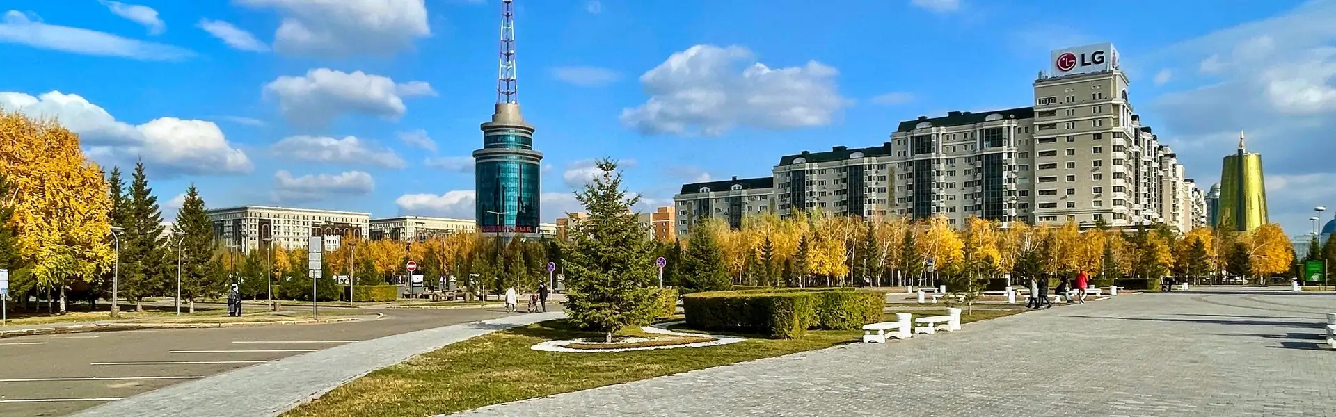
The logic of walking in Astana is simple. There's the Esil river, which splits the city into the right and left bank and gives you the longest walking embankment in the country — almost 10 km. There's Nurzhol Boulevard, the city's parade axis, running ruler-straight from Bayterek to Khan Shatyr. And there are several large parks where you can do a loop in half an hour. No mountains — so the entire script reduces to a combination of "river + parks + boulevards"
The decisive factor in Astana isn't air (it's average city air), it's the wind. The city sits in open steppe, and 5–10 m/s is normal in winter. At −20 with that wind it "feels like" −35. So the rule is simple: in winter, pick routes where buildings or trees break the wind; in summer, the opposite — head to the water for the breeze so you don't bake
Pick a route for your steps and energy
Route picker by steps and effort
Check the wind and air first
Wind matters more than temperature in Astana. windy.com and kazhydromet.kz show speed and direction throughout the day. Simple rule: 5 m/s — comfortable to walk, 10 m/s — postpone or stick to a tree-sheltered park, 15 m/s — stay home or head into Khan Shatyr
Air is a separate story. In summer — dust off the steppe plus exhaust; in winter — emissions from the coal-fired CHP plants TЭЦ-1 and ТЭЦ-2, which settle over the left bank when there's no wind. IQAir and airkaz.org show a city map: on a bad day the left bank below the bridge is often worse than the right. PM2.5: 0–12 — clean, 13–35 — fine, 36–55 — keep it short, 56+ — stay home
Headline routes — river and boulevard
1. Esil embankment
Length: up to 10 km one way · Steps: ~13,500 one way, ~22,000 round-trip (full route) · Profile: flat
This is the city's main pedestrian asset. The path runs along both banks, paved, with cycle markings, lit, with benches every 100–200 m. The best stretch is from the "Mängılık El" Triumphal Arch to the bridge past EXPO: you see Bayterek, the golden towers, the new residential complexes and the Nur-Alem sphere. Runners in the morning, families and cycling couples in the evening
How to get there: buses #10, 12, 18 run along the embankment. Enter at the Palace of Independence, at Khan Shatyr or at the Esil bridge
2. Nurzhol Boulevard: Bayterek → Khan Shatyr
Length: 2.5 km one way · Steps: ~3,500 one way, ~7,000 round-trip
The capital's parade axis. You walk between the House of Ministries and the golden towers, past the fountains and the Northern Gates, all the way to Khan Shatyr. It's the most photogenic walking street in Kazakhstan and a must for anyone visiting the city. The catch — it's exposed and windy; in winter you cover that kilometre fast
How to get there: start at Bayterek (bus #10, BRT), finish at Khan Shatyr (inside is a covered gallery — a place to thaw)
3. EXPO and Nur-Alem — the science district
Length: ~3.5 km full loop · Steps: ~5,000–7,500 depending on length
The capital's "newest" district — the EXPO-2017 complex with Nazarbayev University next door. The Nur-Alem sphere is the headline photo spot. Wide smooth paths with benches. Suitable for short work breaks and visitors. In summer it's hot here (little shade), in winter it's windy (few buildings to shield you)
How to get there: bus #18, 27 or BRT to "EXPO" stop
Parks — where there's less wind
4. Presidential Park
Length: 2 km full loop · Steps: ~3,000
A modern formal park on the right bank, next to Khan Shatyr. Conifer alleys, fountains, smooth asphalt paths. The trees are recent — not much shade yet, but you can hide from the north-west wind among the dense conifer clumps. Stroller-friendly
How to get there: bus #10, 18 or BRT to "Khan Shatyr"
5. Central Park
Length: 2.5 km full loop · Steps: ~3,500
The oldest park on the left bank, near the Palace of Independence and Kazakhstan Square. There's a pond, rides, alleys with mature poplars and willows. The mature trees clean the air better than the avenues nearby, and the wind drops noticeably. Ideal for a 1–2 hour family walk
How to get there: bus #12, 23 to the Palace of Independence
6. Astana Botanical Garden
Length: ~4 km full loop · Steps: ~6,000
A large left-bank park with an artificial lake, bridges and zones organised by continent of origin. It's probably the quietest, greenest spot in the capital — the trees were chosen carefully and have grown into a proper forest in ten years. Air is noticeably cleaner, wind is broken by the plantings
How to get there: bus #18, 32 to "Botanical Garden"
7. Lovers' Park + Triumphal Arch
Length: ~3.5 km full loop · Steps: ~5,000
A shaded right-bank park with walking alleys and ponds. Across the road — the "Mängılık El" Triumphal Arch and a large open plaza. A good way to combine a park and an architecture photo stop. In winter the trees protect you, in summer they give shade
How to get there: bus #10, 12, "Triumphal Arch" stop
8. Aray Park
Length: ~3.5 km · Steps: ~5,500
A family park on the right bank: ponds, fountains, playgrounds, cycle lanes. Less touristy than Presidential, but convenient for daily walks. Nearby — the old Round Square and a residential district where you can add a couple of thousand more steps along quiet streets
How to get there: bus #23, 45
9. First President Park
Length: ~3 km · Steps: ~4,500
A right-bank park around the Baraev/Imanov streets junction. Conifer alleys, ponds, smooth paths. A solid choice if you live on the right bank and don't fancy crossing the river. Quiet, shaded, hardly any tourists
How to get there: bus #70, 73
Winter alternative — indoor walking
10. Khan Shatyr and the malls
Length: 1–2 km along the galleries · Steps: ~2,500–4,000
When it's −30 outside with a hard wind, indoor space is the only honest answer. Khan Shatyr inside is a giant tent with galleries, a tropical garden, rides and a Ferris wheel; walking the whole perimeter is about 1.5 km. Mega Silk Way next to EXPO is another huge mall with long corridors. Mega Astana on the left bank and Keruen downtown are smaller options. It's not "going for a walk", but you can realistically close 5,000 steps a day on a brutal-weather day this way
How to get there: bus #10, 18 or BRT to the relevant malls
Seasons — what works when
Winter (November — March)
The main problem is wind and frost. At −20 with 8 m/s, walks longer than 30 minutes risk frost on the face. What to do: pick windless days (check windy.com), stick to sheltered routes — Presidential Park, Botanical Garden, the embankment downstream of the bridge. On the coldest days — Khan Shatyr and the malls. Layer up: thermals, fleece, down jacket, balaclava, mittens, warm boots
Spring (April — May)
The best season in Astana. The snow is gone, the steppe blooms, +10…+20°C, lighter wind. What to do: tackle the long routes — full Esil embankment, EXPO + Nurzhol, Botanical Garden. The ideal time to chase a "20,000 steps in a day" record
Summer (June — August)
Hot (often +30…+35), but the days are long and you can walk until 22:00. What to do: mornings (before 9) or evenings (after 18:00). Shaded parks — Central, Botanical, Lovers'. Along the water it's always 2–3°C cooler, plus you get a pleasant river breeze
Autumn (September — October)
The second peak after spring. Warm +15…+20, golden steppe, fewer tourists. What to do: get it all done before the end of October — after that the heating season starts, the wind picks up, and the first snow can come on any day
What to bring — a short checklist
- Water. 1.5 L for a long walk along the Esil, at least a bottle for any walk
- Wind protection. Winter — a hooded down jacket and a balaclava; summer — a light jacket so you don't get blown around at Bayterek
- A cap or hat. The steppe sun is fiercer than it looks, especially in May–June
- Comfortable trainers. Everything is flat, but 10–15 km is real load on the feet
- A charged phone. 4G is good across the city, but at −30 the battery dies three times faster
- A mask on a bad day. If PM2.5 is above 50 and you're walking the left-bank avenues
Bottom line
- The two main pedestrian axes in Astana are the Esil embankment (up to 10 km one way) and Nurzhol Boulevard from Bayterek to Khan Shatyr
- No mountains, no real elevation — every route is flat, suitable for any fitness level
- The decisive factor is the wind. In winter, check windy.com and pick sheltered places: parks, inner streets, the embankment downstream of the bridge
- The longest urban route is the full Esil embankment, ~22,000 steps round-trip
- The most postcard-perfect is Nurzhol Boulevard, 7,000 steps with every symbol of the capital
- At −30 — only indoor walking: Khan Shatyr, Mega Silk Way, Mega Astana
- The best season is May and September: warm air, lighter wind, long days
The simple rule: in Astana you can't plan a walk without checking the wind and temperature — the steppe climate decides for you. But if you know five or six trusted routes and a couple of apps, you can hit 10,000 steps in the capital year-round — and almost all of them come with a view of the Esil or Bayterek. And Qozgal will count every one — no subscriptions, no ads, no extra numbers
Count your steps for free
Download Qozgal — an accurate step counter using Apple Health and Health Connect. No subscriptions, no ads