What a barrier-free route means
A barrier-free route is not a promise of a perfect city. It is a route checked in advance: from your home or a bus stop to the walking area, along the path, across the crossing and back. If you have to lift a stroller over one section, go around a puddle via the roadway or spend a long time looking for somewhere to sit, the route cannot be considered comfortable—even if the park itself is wonderful.
- First assess not the attraction, but the route from the bus stop to the entrance.
- To reduce the load, choose a loop or a route where you can turn back at any time.
- The embankment is easier to walk on even surfaces, but wind and bicycles can create separate barriers.
- A bench, restroom, café and nearby bus stop matter more than an extra kilometer.
- Before heading out, check the surface after rain, a thaw or roadwork.
How to check a route before heading out
Maps show distance well, but they rarely show a high curb, broken paving or a bench that offers no support. That’s why it helps to divide the check into two stages: start with the map, then do a short on-site reconnaissance. Research on urban mobility among older people shows that the subjective feeling of comfort and the objective condition of the environment can differ considerably. What looks close on a map may not always be passable in reality. Study data
- Surface. Look for asphalt or even paving without long stretches of cobblestones, potholes, raised manholes or deep joints. For a stroller, width and the absence of sharp crosswise level changes are especially important.
- Curbs. Check not only the crossing itself, but both sides of the street. The curb ramp should lead directly onto the sidewalk, not into a puddle, lawn or parking bay.
- Crossings. Prefer a traffic light, a refuge island and a short crossing over one carriageway. If you have to cross several lanes, allow more time and don’t choose that section alone.
- Rest stops. Mark benches, cafés, a pharmacy, a restroom and the nearest bus stop. One comfortable bench every 300 meters is better than five decorative seats without backrests or armrests.
- Landmarks. A loop with clear entrances and exits is safer than a long straight route where you’ll have to walk the same distance back. Save the route and turnaround point on your phone.
- Weather. In Pavlodar, check not only the temperature but also wind gusts, air conditions and the chance of ice. An open embankment and a quiet park can create very different levels of exertion.
A quick 10-point test Give the route 0–2 points each for the surface, curbs, crossings, rest stops and the ability to shorten the walk quickly. 8–10 points—a good option for an independent walk; 5–7—it’s better to go with someone and have a Plan B; below 5—look for another route. This is not an official standard, but a simple editorial filter for choosing a route.
A review of 17 empirical studies links older people’s mobility with street connectivity, traffic safety, sidewalk quality and the proximity of parks, shops and other everyday destinations. The practical takeaway for a walk is simple: assess not only the park, but the entire route to it.
Open the publication via DOIPavlodar routes that are easier to adapt
Below is not a ranking of the “most beautiful” places, but a set of routes that can be shortened, walked in part or turned into a loop. Distances and bus stops come from the Qozgal city guide and map directories; still, check the surface condition, access to individual entrances and public transport schedules on the day of your walk. We’ve also written separately about walking with a stroller and walking for older adults.
| Route | Distance and steps | What’s convenient | What to check |
|---|---|---|---|
| Embankment: River Terminal—Satpayev | ≈2,5 km one way; ≈5 km there and back; about 6–7 thousand steps | Even central promenade, benches, streetlights | Wind, bicycles, sections under repair |
| Square by Mashkhur Zhusup Mosque | ≈1 km loop; about 2,5 thousand steps | Short walk in the center, clear landmarks | Curb ramps at entrances and paving condition |
| Gorky Park | ≈2,5 km large loop; about 4,5 thousand steps | Mature trees, shade, paths and benches | Different surfaces inside the park |
| Victory Park | ≈2,5 km loop; about 5,5 thousand steps | Quiet paths, trees, places to pause | Open sections and winter ice |
| Gagarin Park | ≈1–2 km short loop; about 1,5–3 thousand steps | Updated amenities, benches, lighting | Current entrance and surface after precipitation |
1. The Irtysh embankment: the clearest long option
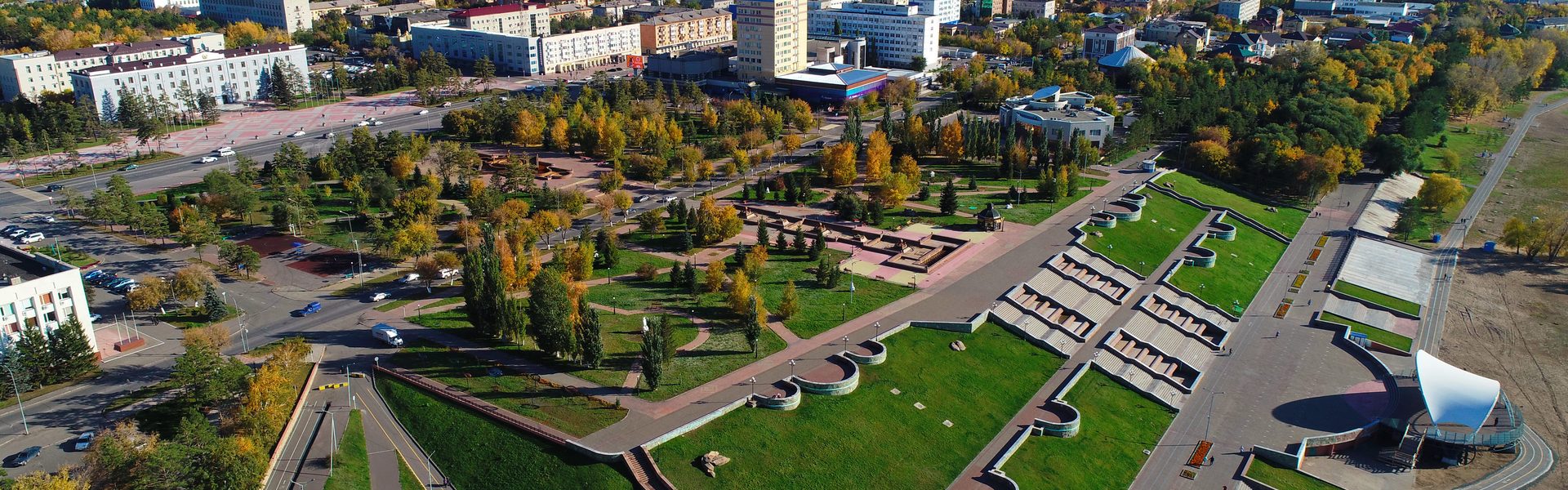
Start at the River Terminal and walk toward Academician Satpayev Street. The central stretch is about 2,5 km one way, so you can choose any distance: 500 meters, 1 km or the entire section to a turnaround point. There and back comes to roughly 5 km and about 6–7 thousand steps, though the number will be higher for someone with a shorter stride. The route description and transport options are available in the Pavlodar walking city guide.
This is a good choice for a stroller or cane if you need a long, level stretch without climbs. According to the published description, the embankment has a hard surface, a cycle path, streetlights and benches at short intervals. To reduce the load, don’t set a goal of “reaching the end”: choose a bench or a noticeable landmark 10–15 minutes away and turn back while you still have energy in reserve.
The embankment isn’t always easy Open water makes the wind stronger. In strong gusts, walk closer to the buildings or move your walk to a park. Keep the pedestrian and cycling areas separate, don’t suddenly move into the path and signal your maneuver in advance. In the cold season, a separate checklist for ice and wind is useful: wind on the Irtysh embankment.
2. The square by Mashkhur Zhusup Mosque: a short walk in the center
The loop around the square is approximately 1 km, or about 2,5 thousand steps. This is a 20–30-minute option when you want to get out of the house but a longer route isn’t suitable yet. There are visual landmarks, a fountain and places to rest. You can reach the central area by public transport; route №7, for example, passes the stop near Mashkhur Zhusup Mosque. Check the stops on route №7.
Before your walk, inspect the entrance from the bus stop side: a short route loses its value if the last 100 meters are along a broken sidewalk. If you’re using a stroller, choose the widest entrance and don’t plan to go around the entire square via the lawn. For someone using a cane, a bench with a backrest and the option to quickly reach the road or a café are important.
3. Gorky Park: shade and the option to walk in loops
The large loop through the park is about 2,5 km, or approximately 4,5 thousand steps. Mature trees provide shade in summer and partial protection from the wind in cooler weather. The park works well as a training route: first walk a short section between two benches, then add a second one. According to the published guide, you can get there by buses №2, 11 and 16 to the “Gorky Park” stop.
To reduce the load, you don’t have to stick to the outer perimeter. Choose inner paths with fewer crossings and mark a place where you can finish the loop in advance. After rain and the spring thaw, check whether puddles or muddy sections have appeared: the park may be comfortable in summer and inconvenient in the shoulder season.
4. Victory Park: a peaceful route with pauses
The estimated length of the large loop is 2,5 km, or about 5,5 thousand steps. The park suits people who value a quiet walk more than cafés and entertainment nearby. Trees, paths and the memorial area create a clear structure, and you can divide the route into two short outings. The city guide lists buses №7 and 14 to the “Victory Park” stop.
Check exactly where the benches are and whether they have backrests. For someone with back pain or weak legs, a seat without support can be uncomfortable. In winter, assess not only the central path but also the approach from the bus stop: a cleared park doesn’t mean the entire route to it is safe.
5. Gagarin Park: a short loop and a family-friendly format
For your first walk, you can plan a short loop of about 1–2 km—around 1,5–3 thousand steps. It’s best to measure the exact length along your chosen paths in an app, because the entrances and inner paths offer different options. According to reports from the city authorities, the park’s paths were upgraded, and benches, bins, lighting and an inclusive children’s playground were installed. Information about the park improvements.
A map directory lists one of the park’s addresses as 4/1a Vorushina Street. Open the park location in 2GIS. Before your trip, confirm the nearest entrance: for a stroller, the difference between an entrance with an even sidewalk and one that requires crossing a curb can be significant. The park is especially convenient when an adult needs a short walk and a child needs a playground nearby.
This systematic review looks specifically at small details of the urban environment: sidewalk material and condition, manholes and cracks, benches, bollards, steps, ramps, curb ramps, and visual and audible crossing signals. For people with limited mobility, these elements can determine whether they can complete a route independently.
Open the publication via DOIHow to count distance without overexerting yourself
Steps are a useful metric, but not a precise unit of distance. A person with a short stride, a cane or a stroller will have a different pace and stride length from average figures. So use two measures at once: kilometers to plan the route and your own steps to monitor the load. The first time, walk a familiar 500 meters, see how many steps your phone records and use that personal ratio.
- Start with a route where you can turn back after 10–15 minutes, rather than the maximum distance.
- Leave a reserve: returning tired against the wind is harder than walking in one direction.
- Plan a stop before severe fatigue appears, not afterward.
- If you’re using a stroller, consider not only kilometers but also time spent at crossings, waiting for traffic lights and going around obstacles.
- If you use a cane or walker, avoid routes where you have to constantly watch your feet: uneven surfaces increase both physical and cognitive load.
- If you experience pain, dizziness or unusual shortness of breath, stop and return by a safe method. If you’re recovering from an illness or surgery, agree on the amount of walking with a specialist.
A good route doesn’t end when you reach your destination, but when you still have enough energy to return calmly.
When to walk in Pavlodar
In summer, choose morning or evening, especially for the open embankment. In the middle of the day, young trees and wide open spaces provide little shade, and heat increases fatigue faster. In the shoulder season, check for puddles, mud and the condition of the paving after rain. In winter, a short route in the center or a loop in a sheltered park is often wiser than a long walk by the water. If you specifically want to walk along the embankment, check the wind-gust forecast in advance and read the recommendations for walking in windy weather.
Make a Plan B Write down the nearest bus stop, café or shopping center next to the route—somewhere you can warm up and rest. For longer outings, tell someone close to you where you’re going. If the route turns out to be worse than expected, shortening the walk isn’t a failure, but normal city navigation.
A review of 52 studies shows that older people assess the urban environment by more than distance alone. Sidewalks, safety, greenery, the ability to stop, how easy the space is to understand and overall comfort all affect the sense of accessibility. That’s why you should check a route with your eyes and feet, not only by following a line on a map.
Open the publication via DOIFAQ: barrier-free walks in Pavlodar
Which route should I choose for my first walk with a stroller?
Start with a short section of the embankment or a loop in Gagarin Park. The embankment makes it easier to control the distance: you can turn back after 500 meters or 1 km. Before heading out, check the entrance, curbs and separation from the cycle path.
How many steps are enough if I get tired quickly?
Don’t follow a universal number. For your first outing, 20–30 minutes of calm walking with an opportunity to sit matter more than a specific step count. If you recover normally after the walk, add 5–10 minutes rather than several kilometers at once.
Where in Pavlodar is the exertion from climbs lower?
The central section of the embankment and most of the parks described here are generally flat. But a climb may appear on the approach to an entrance or crossing, so check the final 100–200 meters separately.
Can I walk along the embankment in winter?
Only after checking the surface, temperature and wind. Ice, snow and crosswinds can sharply increase the difficulty even of a flat route. If in doubt, choose a short park near home or move your walk indoors.
How do I know whether there are enough benches along the route?
Note not only the number of benches, but also the distance to each next rest point. On a relaxed walk, it’s better to be able to see the next bench in advance. Seats with backrests and armrests are more comfortable, especially if it’s difficult for you to stand up.
Bottom line: choose the most manageable, not the prettiest, route
For your first walk in Pavlodar, start with 1 km along the embankment or a short loop in a park. Then assess not only your fatigue but also the obstacles: where you had to slow down, where there weren’t enough benches and which curb was uncomfortable. After several outings, you’ll have your own map of the city’s comfortable sections.
The most practical principle is this: an even surface, a safe crossing, a clear turnaround point and a place to rest matter more than an extra two thousand steps. That’s how the city becomes more accessible—not in words, but on every specific route.
Sources
- Rosso et al. A review of the connection between the urban environment and older people’s mobility: sidewalks, safety, street connectivity, parks and everyday destinations. Journal of Aging Research, 2011
- Michael et al. A study of 105 older people showed that objective assessments of the environment and perceptions of a route can differ; it is useful to check a route on site. Journal of Aging and Physical Activity, 2006
- Grasser et al. A systematic review of how micro-details of streets affect people with limited mobility: surfaces, curbs, ramps, benches and crossings. Journal of Transport & Health, 2024
- Viana et al. A review of older people’s perceptions of the urban environment: accessibility, sidewalks, safety, greenery and places to rest. Applied Ergonomics, 2022
- Qozgal’s city guide to Pavlodar routes: walking distances, landmarks, parks, the embankment and transport options. Qozgal — Pavlodar routes
- A report on improvements to Gagarin Park: paths, benches, lighting and an inclusive children’s playground. Pavlodar Region Akimat
- A map listing for Gagarin Park with the address of one of its entrances. 2GIS — Gagarin Park
- City minibus route №7 with stops and its direction of travel around Pavlodar. Route №7 in Pavlodar

