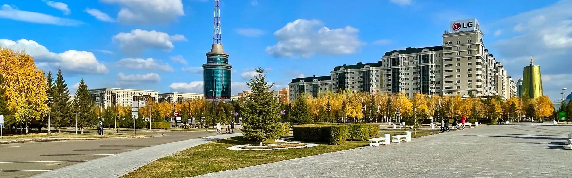
Choose a Convenient Starting Point, Not a Distance
In Astana, it’s easier to plan a walk around a place with continuous pedestrian paths: the Botanical Garden, Nurzhol Boulevard, or the riverfront near Central Park. That way, you won’t have to walk along a major road for a long stretch just to reach a pleasant area. For other city walks, check out the guide to walks in Astana.
The main thing to keep in mind when planning is the wide roads and large blocks. A straight line on the map doesn’t always match the most convenient walking route: the only crossing may be at an intersection, while the park entrance you need may be on the other side. So first mark your starting point, destination, and suitable crossings on the map, then decide how long you want to walk.
How to Read the Distances in This Guide The route distances below are planning estimates, not exact measurements of paths that are currently open. Check the map and access to paths before you set out: paths, entrances, and temporary restrictions can change. Step counts are estimated using about 1,400 steps per kilometre—your total will depend on your stride length, pace, and stops.
How Far Can You Walk in 20–60 Minutes?
If you’re sightseeing, waiting at traffic lights, and taking photos, don’t expect to walk at an exercise pace. Use the ranges below as a starting estimate, not a promise that you’ll cover exactly that distance. If step count matters more to you, compare the estimate with your phone or tracker; for more on converting steps, see “How Many Kilometres Are in Your Steps?”.
These estimates assume a relaxed or moderate pace and a few brief stops; a long wait for a signal can add quite a bit of time. If you’re walking with a stroller, with a child, or on a slippery winter path, leave extra time and plan for the shorter end of the distance range. It’s easier to choose a duration first and then make a loop than to try to hit a set step count at all costs.
How to Choose Crossings and Avoid an Unsafe Detour
On a wide avenue, don’t choose where to cross based only on what seems most convenient. Use a marked crossing and follow the traffic signals. If your route includes an underpass or footbridge, check in advance whether it has approaches, stairs, or ramps, and whether you’re comfortable using them. Don’t cut through barriers, across medians, or at unmarked points—especially if you can’t clearly see oncoming traffic or you’re walking at dusk.
- Check exactly where you’ll cross each wide road: at an intersection, a signal-controlled crossing, or on an official pedestrian route.
- If a safe crossing takes you noticeably out of the way, build that detour into your route in advance—don’t decide on the spot to dash across the road just to save a few minutes.
- For a loop spanning several blocks, check both sides of the avenue: being able to cross on the way there doesn’t mean there will be a convenient crossing nearby on the way back.
- In an unfamiliar area, use the map as a guide, not proof that a route is safe: follow signs and traffic signals, and stick to available sidewalks.
A review of research on pedestrian route choice highlights that routes depend on the context and on how people perceive their surroundings. The practical takeaway for a walk in Astana is simple: compare not only the distance on the map, but also crossings, sidewalk continuity, and how easy it is to return. This is a review of research, not a measurement of routes in Astana.
Tong Y, Bode NWF. The principles of pedestrian route choice. 2022.In a study of routes in Sapporo, participants chose paths based on more than distance: sidewalk and crossing quality mattered too. On longer routes, pedestrians were more likely to take a detour from the shortest path in favour of a more comfortable environment. This supports the value of planning crossings and choosing good paths in advance, but the findings can’t be treated as measurements for Astana.
Muraleetharan T, Hagiwara T. 2007.Research doesn’t provide a ready-made map of safe crossings in Astana. It does help illustrate one principle: the most convenient route isn’t necessarily the straightest one. Choose a predictable path with clear sidewalks and crossings over a shorter cut through an awkward stretch.
Three Walks That Bring You Back to Your Starting Point
1. Botanical Garden: A Green Loop for 20–60 Minutes
A convenient starting point is the entrance to Astana Botanical Garden on the Orynbor Street side. The official Visit Astana map lists the address as 14D Orynbor and shows public transport nearby; check the current bus route in an app before setting out. The garden itself lists the administrative building at 14B Orynbor and confirms that it has a park area. Entrances to different facilities may vary, so follow signs to the visitor entrance rather than relying on the institution’s address alone.
For a short walk, take the main open path from the entrance towards the centre of the garden, choose another internal path, and return to the same entrance. Plan for about 1.5–2 km—around 2,100–2,800 steps or 20–30 minutes without long stops. It doesn’t have to be a closed loop: going out and back along a familiar path is convenient too, and saves you from having to exit onto an avenue.
If you have 40–60 minutes, add another loop along the paths that are open. Aim for about 3–4.5 km, or roughly 4,200–6,300 steps. Don’t try to walk the entire perimeter without checking on the map that the paths are open and connected. For your first visit, it’s better to choose a short loop and leave time to enjoy the garden at a leisurely pace.
2. Nurzhol Boulevard: A Walk Along the City’s Main Axis
Start at Baiterek—the official tourism resource lists its address as 14 Nurzhol Boulevard—and choose a direction: towards the Akorda residence or towards Khan Shatyr. The boulevard runs between these landmarks and is designed for walking. The official Visit Astana map also shows bus stops near Baiterek and the boulevard; check your specific route to the starting point before you travel.
For a 20–30-minute walk, head away from Baiterek along the pedestrian axis for 10–15 minutes, then turn back. Depending on where you turn around, you’ll cover about 1.5–2.5 km—around 2,100–3,500 steps. This route is especially convenient if you don’t want to cross major roads: the walk stays on one pedestrian axis, and you finish where you started.
For 40–60 minutes, continue farther along the boulevard, but choose your turnaround point in advance and don’t add side streets just to make the route look pretty on the map. Aim for about 3–5 km there and back. If you want to finish at a different landmark, check in advance how you’ll get back to a bus stop or your starting point: a direct one-way route isn’t always a convenient plan for the return journey.
3. Central Park and the Riverfront: A Flexible Route
For a waterside walk, start around Central Park or the Demalys Promenade pedestrian area and follow an accessible stretch of the riverfront. Visit Astana includes Central Park, the riverfront, and a walk across the Atyrau and Seruen bridges in its city tourist route. These are useful landmarks, but check the condition and access to specific paths on site.
For 20–30 minutes, choose a short stretch of the riverfront and return the way you came: depending on where you turn around, that’s about 1.5–2.5 km. For 40–60 minutes, you can extend the distance to 3–5 km or make a loop across a bridge, if the approaches are open and the paths on both sides connect. Don’t include a bridge crossing in your plan until you’ve confirmed there’s a safe way to reach it from your side.
Check Your Loop Before You Set Out Set the same point as both your starting point and destination on the map. Then zoom in around every major avenue: is there a crossing where you need one, and are the paths connected? If the map suggests a strange detour or shows a sidewalk ending, choose an out-and-back route instead of a questionable loop.
How to Compare Routes and Choose Yours
| Route | Best if | Planning estimate |
|---|---|---|
| Botanical Garden | You want more green paths and fewer crossings of major roads | 1.5–4.5 km; check which internal paths are open |
| Nurzhol Boulevard | You want a clear starting point and a linear route with a turnaround | 1.5–5 km there and back |
| Central Park and the riverfront | You want a waterside walk and are willing to check whether bridges are accessible | 1.5–5 km; distance depends on which connections are open |
The figures in the table are ranges for planning your own walk, not official distances for marked routes. Open the pedestrian mode in your map app, plot a route along sidewalks, and compare the total with the time you have in mind. If the service suggests a route via a vehicle ramp or an unclear passage, don’t assume it’s suitable just because it’s shorter.
The authors studied stated preferences among survey participants in three urban areas in England near busy roads. Travel time, accessibility, and a personal sense of comfort influenced their choice of crossing type; on average, participants rated underpasses and footbridges lower than signal-controlled at-grade crossings. This study looks at preferences, not the actual safety of all crossings, and it was not conducted in Astana.
Anciaes PR, Jones P. 2018.A good loop isn’t a perfect circle on the map. It’s a route where you know in advance how you’ll get back to your starting point without taking risks at crossings.
Before You Go: Transport, Weather, and a Backup Plan
To get to your starting point, enter the location in a current public transport or maps app. The Visit Astana tourist map includes addresses and bus information for Baiterek, Nurzhol Boulevard, and the Botanical Garden, but schedules and routes may change. Don’t base your whole walk on a bus number from an old article: check your trip again on the day.
In cold weather, after snowfall, or during a thaw, choose well-lit, cleared paths, shorten your loop, and don’t count on a crossing if you can’t confidently navigate the surface. In strong winds or bad weather, it’s more practical to choose a short, familiar stretch where you can turn back at any time. On a warm day, bring water; at dusk, choose a well-lit route and don’t wear headphones so that you can’t hear the traffic around you.
If you’re unsure between two plans, choose the one where your start and finish match and you cross fewer wide roads. You can always make the walk longer with an extra loop in the park or along the boulevard if you have enough time and energy. That makes it easier to stop when you want to, without turning your break into a race to complete a route.
- First choose a convenient pedestrian area and starting point, then plan your route around the time you have.
- Cross wide roads only at marked crossings; factor in the detour to reach one.
- For your first visit, choose an out-and-back route rather than a complex loop through streets you haven’t checked.
- Distances in kilometres and steps are estimates: check your route on a map and against your own tracker.
- Before you travel, recheck transport, open entrances, and path conditions.
Frequently Asked Questions
Which route should I choose for a 20-minute walk in Astana?
Choose a short stretch of the Botanical Garden or Nurzhol Boulevard and return to your starting point the same way. That makes it easier to keep track of time and avoids having to find a crossing in an unfamiliar block. Aim for about 1.2–1.7 km, but the actual distance depends on where you start and how fast you walk.
Can I walk from Baiterek to Khan Shatyr?
Nurzhol Boulevard connects landmarks in the direction of Akorda and Khan Shatyr, and you can plan a walk along it. But if you’re short on time, check the pedestrian route distance on a map in advance and decide whether you’ll walk back or take public transport. Don’t estimate by a straight line: entrances and accessible paths matter.
How many steps is a 3 km walk?
This guide uses about 1,400 steps per kilometre as a rough estimate, so 3 km is about 4,200 steps. That isn’t a universal figure: stride length varies. If you have a tracker or phone, use its readings and compare them with your usual routes.
Does a route have to be a closed circle to count as a loop?
No. Walking along a convenient path to a chosen point and returning the same way is a practical way to get back to your starting point, especially when blocks are long and crossings are few. Choose a closed loop when you’ve checked that the paths connect and that there are crossings over the roads.
If you want to keep walking beyond the parks, start with a short, familiar route and gradually add distance. In an unfamiliar part of the city, keep your plan flexible: a safe crossing, an open path, and an easy return matter more than a few extra hundred metres.
Sources
- Tong Y, Bode NWF. The principles of pedestrian route choice. Journal of The Royal Society Interface. 2022. DOI
- Muraleetharan T, Hagiwara T. Overall Level of Service of Urban Walking Environment and Its Influence on Pedestrian Route Choice Behavior. Transportation Research Record. 2007. DOI
- Anciaes PR, Jones P. Estimating preferences for different types of pedestrian crossing facilities. Transportation Research Part F: Traffic Psychology and Behaviour. 2018. DOI
- Visit Astana. Interactive map: tourist attractions, addresses, and transport. Official map
- Astana Botanical Garden. Official website: addresses, visitor guidelines, and information about the garden. Official website